Dashboard guides · Simple view
The simple view, step by step
The simple view tells you the weather where you are in one sentence and, below it, everything you need to plan your day: warnings, today and tomorrow by time of day, hour by hour and the next seven days. No acronyms, and in your local time.
Before you start
- 1Open the dashboard in the simple view. At the top you choose the mode: «Simple · Enthusiast · PRO». The simple view is the one that opens the first time.
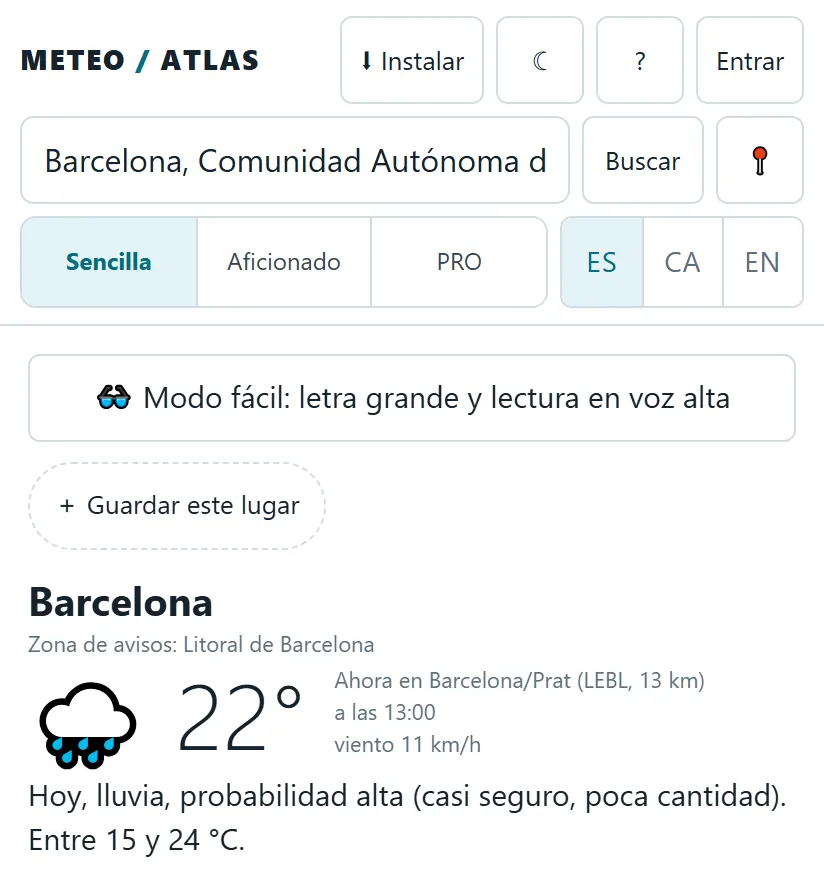
Open the simple view - 2Find your town. Type it in the box at the top and press «Search», or tap «📍» to use your location. With «+ Save this place» you will have it one tap away next time (home, work, the village).
Are there any warnings?
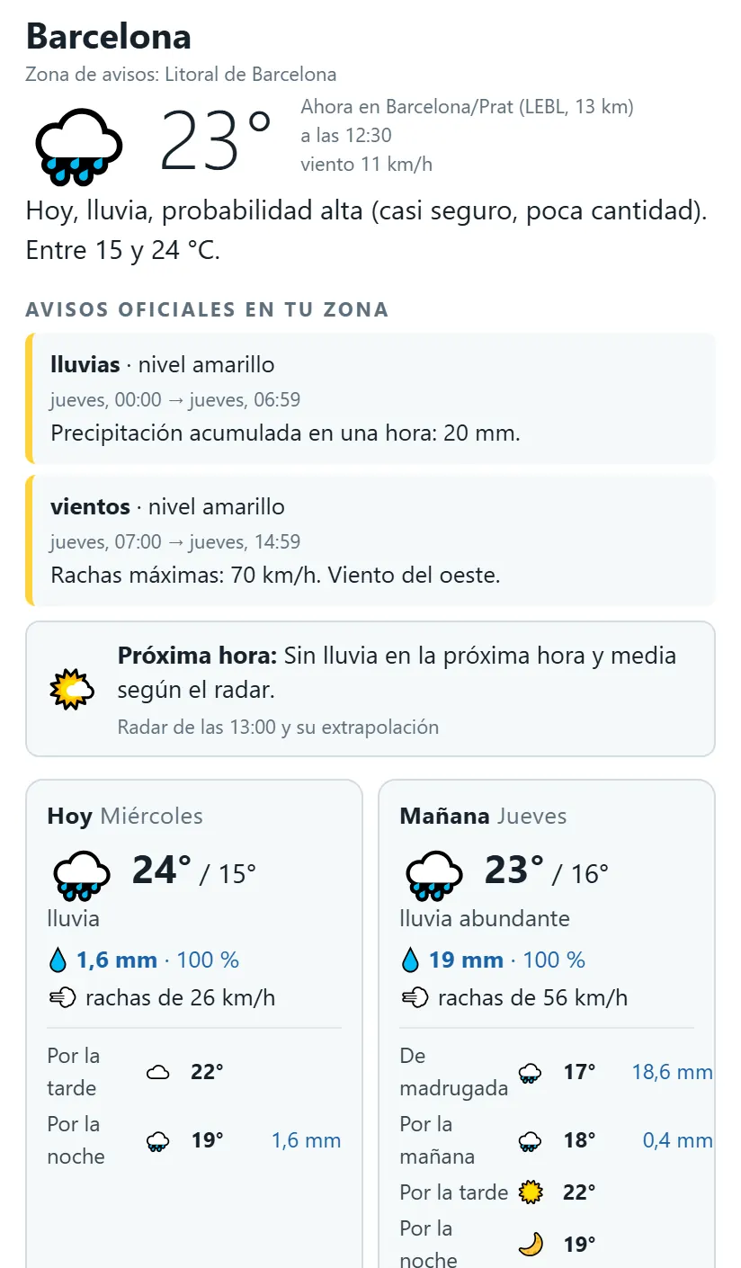
- 1Read the sentence at the top. Below the name of the place you will find its warning zone (for example, «Litoral de Barcelona»), the current temperature measured at the nearest station and a sentence about today.
- 2Look at «Official warnings in your area». These are AEMET's, current or expected: what they are for (rain, wind, coastal…), the level (yellow, orange or red), from when until when and what they expect.
- 3To see them on the map, tap «⚠️ Warnings» in the buttons above the map. And if you want us to alert you on your phone, choose ⚠️ under «Get notified»: you will get an alert when AEMET issues an orange or red warning for your area.
What will the weather be like tomorrow?
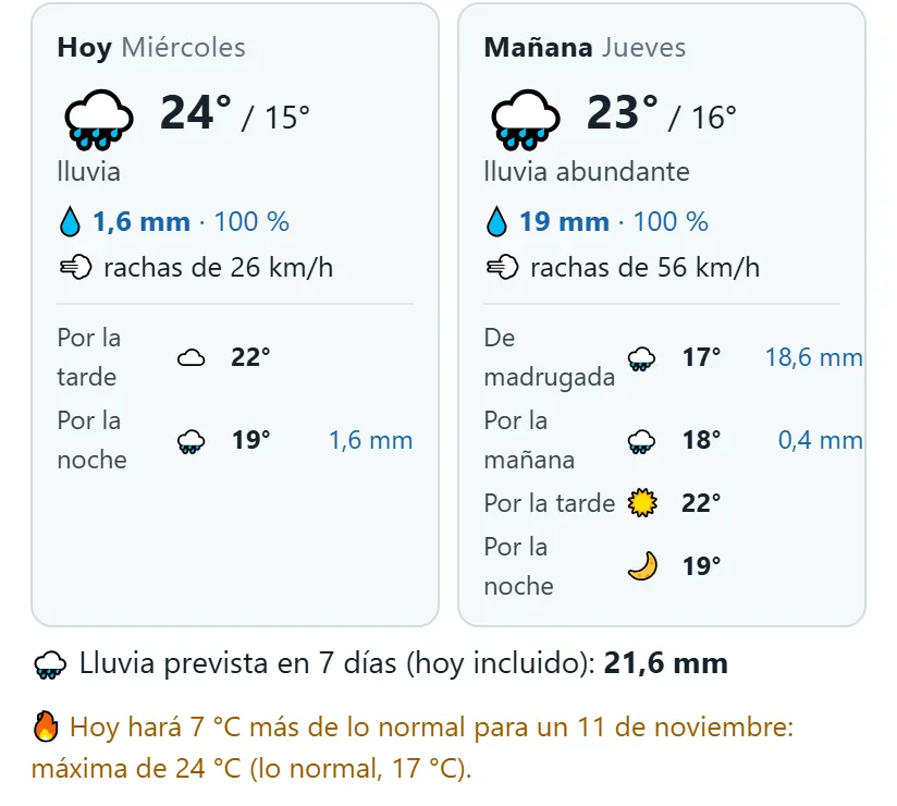
- 1Look for the «Tomorrow» card. It is next to «Today»: the sky, the high and the low, a word that sums it up («heavy rain»), the expected rain with its chance (💧 19 mm · 100 %) and the wind gusts (💨).
- 2Look at the times of day. Below, the day is split into overnight, morning, afternoon and night, with the temperature and rain for each. That way you know whether it rains at night or just as you go out.
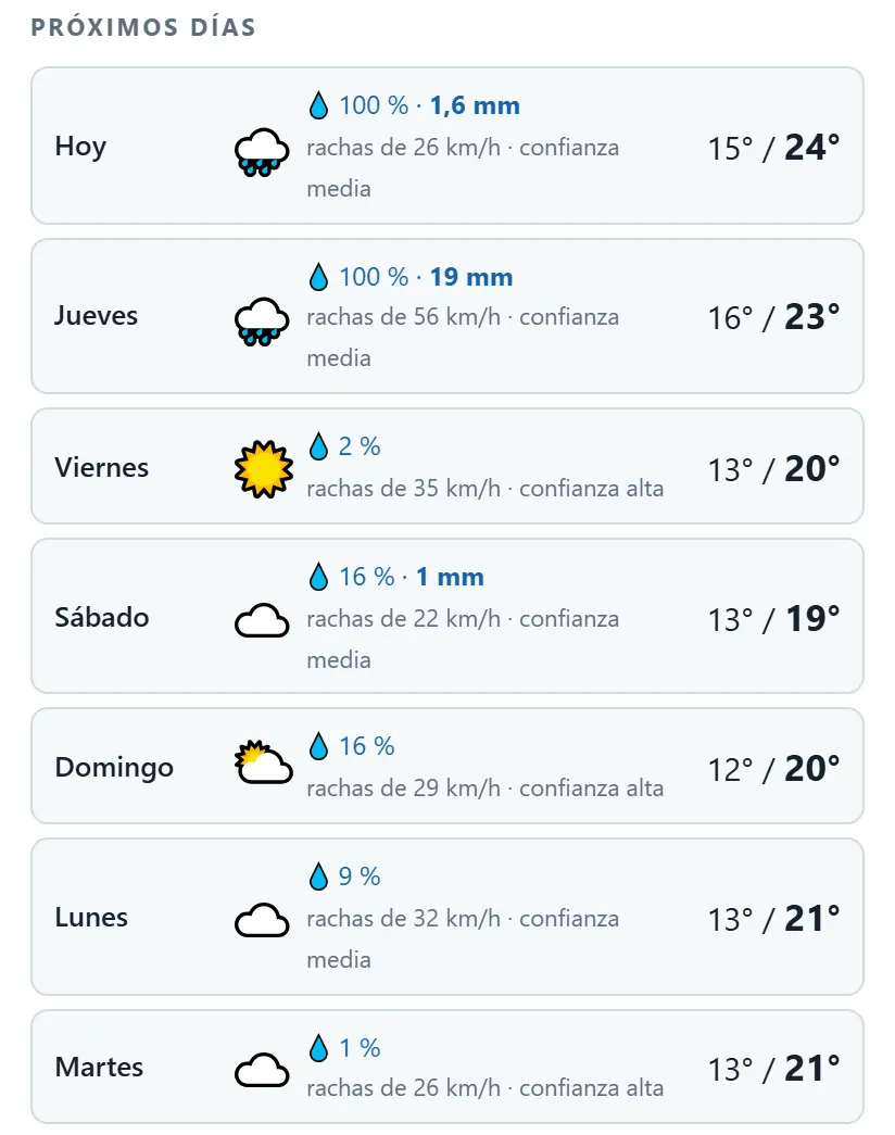
- 3And the day after? «Next days» goes up to seven days, one per row.
Will it rain? When?
- 1In the next hour and a half: the «Next hour» card looks at the radar and tells you whether rain is on its way. It is the most reliable thing for right now.
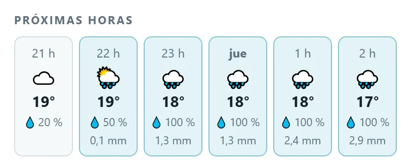
- 2Hour by hour: in «Next hours», swipe the strip to the left. Each hour has its sky, the temperature, the chance of rain (💧) and the millimetres. After midnight you will see the name of the day.
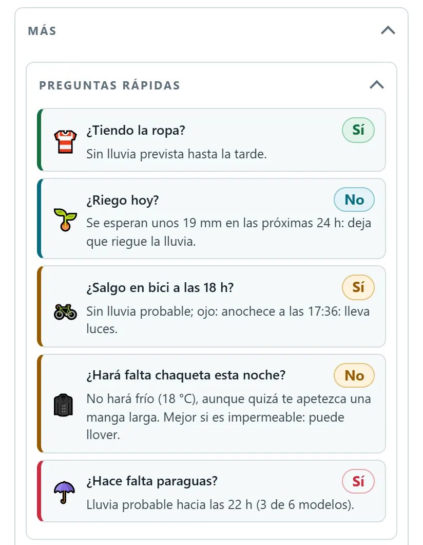
- 3The direct question: open «More» and look for «Quick questions». «Need an umbrella?» answers yes or no and why: at what time and how many models see it.
- 4Our own forecast: the «Atlas Forecast» tells you between what times it is likely to rain and how much, learned from what the stations measure. It appears in the areas where it is already switched on.
Will it be windy?
- 1Look at the 💨 on each day. «Today», «Tomorrow» and «Next days» show the gusts, which are the strongest blasts of wind expected.
- 2On the map, tap «💨 Wind» above the map to see where it blows hardest.
- 3As a rough guide: with gusts of 50 km/h it is already hard to hold an umbrella; from about 70, depending on the area, AEMET usually issues a yellow warning.
How far can I trust it?
- 1Look at each day's «confidence». In «Next days», each row ends with «high confidence», «medium» or «low». It sums up how much the six weather models agree with each other: if they all say the same, high; if each one goes its own way, low.
- 2The rain percentage (💧) is the chance: 100 % means nearly all the calculations see it; 20 %, that only a few do.
- 3If you want an explanation, «🧙 The Sage says…» (inside «More») tells you in plain words and with its own confidence. An AI writes it from our data, and every figure is checked before it is shown.
More things you can do
- «Get notified»: choose what you want us to alert you about (rain tomorrow, frost, strong wind, lightning nearby…) and it reaches your phone.
- «When is best for…?» (in «More»): the best slot in the next 48 hours for running, cycling, hanging out the washing or watering.
- «📤 Share as image»: send the forecast on WhatsApp or social media.
- «What's the weather like where you are?»: tell us whether it is raining or sunny. It helps check the radar.
Want to see the model maps? Carry on with the Enthusiast view guide. Something easier? The easy mode guide. All of them, in Guides.
Atlas does not replace official warnings. To make decisions, follow AEMET, Meteocat in Catalonia and Civil Protection.