What you can do with METEO / Atlas
From knowing whether you will get wet in the next hour to planning a week of work in the forest. Without an account you can see everything; with one, you save your places and get alerts.
Simple view · for everyone
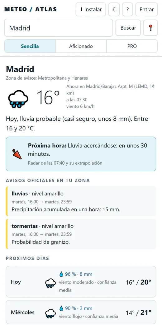
The weather where you are, in one sentence
- Now: what is being measured near you, if there is a station close by.
- The next hour: whether rain is on its way, from the radar and its extrapolation up to 90 minutes ahead.
- Official AEMET warnings for your area, current or expected.
- Atlas Forecast for 48 hours: our own forecast, learned from what the stations measure, with its margin and the why (today in Catalonia; switching on province by province).
- Four days with the chance of rain, wind, temperatures and how confident the forecast is.
- Quick alerts: “tell me if it will rain tomorrow”, “if there is frost”, “if it gets very windy”.
- On your phone like an app: install it from the browser and get alerts even when it is closed.
Enthusiast view · for weather followers
The model maps, side by side
Maps from six models
Temperature, wind, gusts, rain, instability, pressure, 500 hPa height and vertical velocity at 700 hPa (where air rises and clouds form), in 3-hour steps over 4 days.
50 ECMWF scenarios
The probability of 1, 10, 25 or 50 mm of rain, of heat or of frost, and the spread of scenarios at every point.
What is happening now
Radar with a 90-minute extrapolation, the European MTG satellite, lightning, stations and AEMET's 233 warning zones.
Detected phenomena
Cut-off lows, depressions, explosive cyclogenesis, thunderstorms, heavy rain, gusts, heat and frost, with the rule that triggers each one.
Past episodes
Pick any date since 2022 and replay the episode with the models of the time. Save your cases in the notebook.
Your alerts
“Tell me if, at this point, in the next 24 hours, at least 4 models give more than 20 mm.” You set the rules.
PRO view · for professionals
Tools by sector
All three use the same data as the rest of the dashboard and end in a concrete answer: what to do and when. Each one has a printable report and can send it by email every morning.
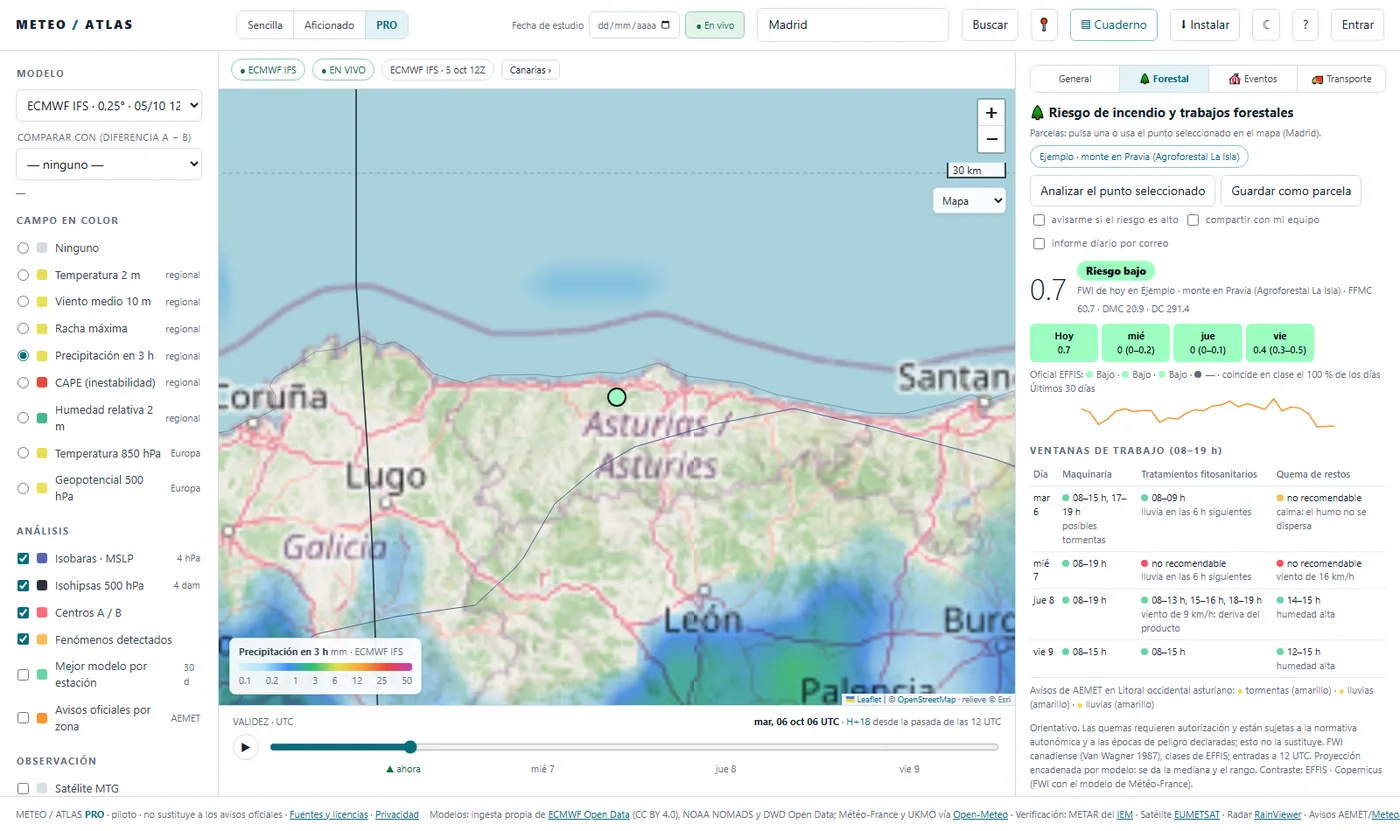
🌲 Forestry
- Wildfire risk (FWI) for each plot, today and the next three days, with the range across models.
- Checked against the official European index (EFFIS, from Copernicus), with how often they agree.
- Work windows from 08:00 to 19:00 for machinery, plant protection treatments and burning debris, with the reason when it is not advisable.
- A daily alert if the forecast risk reaches “high”.
🚚 Transport
- Your road route, with a checkpoint every 15 km.
- The weather on each stretch at the time you will pass it.
- Crosswind for your vehicle (van, empty or loaded lorry), snow, ice, rain and warnings.
- The best time to set off in the next 24 hours and a route sheet for the driver.
🎪 Outdoor events
- An hour-by-hour traffic light with the reason for each colour.
- Based on your set-up: open air, marquees or a stage.
- When it is worth deciding and how reliable the forecast is.
- An alternative: another day at the same time or another time on the same day.
For working as a team
Company teams
Invite your people with a link. Owner, editor or reader: everyone sees what they need, and plots, routes and events are shared.
Reports and alerts
A daily report by email first thing in the morning and alerts on the phone or computer of everyone on the team.
API
Connect the summary, warnings, wildfire risk, events and routes to your own tools, with a key and a daily quota.
See it for yourself
You do not need an account to look around. Search for your town or click on the map.